

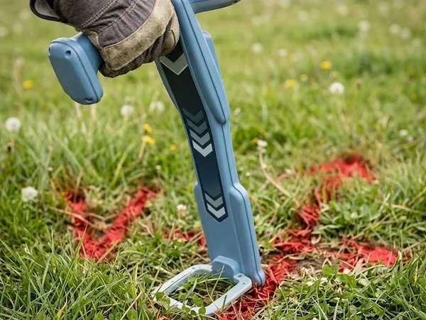
A digging project can look straightforward from the surface. Then an excavator bucket hits an unmarked line, and a routine job suddenly becomes a safety incident, service interruption, repair expense, and project delay. Underground utility locating helps identify buried infrastructure before excavation begins, giving contractors and property owners better information about what lies beneath the work area. The challenge is that underground conditions are rarely as simple as they appear on a site plan.
The Ground Beneath a Jobsite Is Never Just Dirt
Buried infrastructure can include electrical cables, natural gas lines, water services, sewer pipes, telecommunications cables, and other utility networks. Some are installed according to documented plans, while older properties can have incomplete, outdated, or inaccurate records.
Depth can also vary. A utility that appears to be several feet underground in one section can become shallower farther along its route because of grading, landscaping, erosion, previous construction, or changes made during earlier repairs.
That is why a clear surface does not necessarily mean a clear excavation path.
One Dig Can Intersect Several Different Systems
Utility corridors often contain multiple services running through the same general area. A contractor working near a building foundation, road, parking area, or existing service connection could encounter several types of infrastructure within a relatively small footprint.
This becomes especially important during projects such as trenching, fence installation, landscaping, drainage work, foundation construction, irrigation installation, and road improvements.
The location of one utility does not establish the location of another. Each buried service needs to be identified and considered independently before excavation proceeds.
How Locating Technology Reads What You Cannot See
Modern locating equipment can use different technologies depending on the utility and site conditions.
Electromagnetic locating is commonly used to trace conductive underground utilities. A signal is introduced into a conductive line or detected from an existing signal, allowing the locator to follow the utility’s route from the surface.
For non-metallic or difficult-to-trace infrastructure, other methods can be considered. Ground-penetrating radar, for example, uses electromagnetic waves to identify subsurface changes that can indicate buried objects or structures. Its effectiveness depends heavily on soil composition, moisture, depth, object characteristics, and site conditions.
No locating technology should be treated as a magic window into the ground. The quality of the result depends on the equipment, the technician’s interpretation, the utility itself, and the conditions surrounding it.
Depth Is Information, Not a Guarantee
One of the most important distinctions in utility locating is the difference between horizontal position and depth.
A locator can identify where a detected utility appears to run and estimate its depth under suitable conditions. However, depth readings are not the same as an exact measurement of the utility’s physical position. Soil conditions, signal distortion, interference, utility configuration, and other factors can affect readings.
Excavation planning should therefore use locating information as part of a broader process rather than assuming that a marked line represents a perfectly precise underground boundary.
Why Professional Locating Goes Beyond Surface Markings
The visible paint or flags on a jobsite are only the final result of an investigative process. Utility locating services involve interpreting site conditions, tracing underground routes, identifying potential conflicts, and communicating findings clearly to the people responsible for excavation.
A thorough approach considers the planned excavation area as well as the surrounding infrastructure. Nearby utilities can cross, change direction, branch toward buildings, or run along unexpected paths.
Documentation also matters. Marked locations, measurements, photographs, site sketches, or other records can provide useful references as work progresses, particularly on larger projects where excavation takes place over multiple stages.
Planning the Dig Around What Was Found
Once buried infrastructure has been identified, the next step is incorporating that information into the excavation plan.
The project team can adjust trench routes, excavation boundaries, equipment positioning, or work methods when a conflict is identified. In some situations, careful exposure or daylighting of a utility can provide additional confirmation before mechanical excavation proceeds near it.
This is particularly important around critical infrastructure. A damaged telecommunications cable can interrupt connectivity, while striking a water line can flood an excavation area. Contact with electrical or gas infrastructure can create significantly more serious hazards.
The cost of investigating underground conditions before excavation is therefore connected not only to preventing repairs but also to managing safety and project continuity.
Underground Utility Locating Starts Before the Excavator
The strongest excavation plans begin before the first bucket enters the ground. Underground utility locating provides information that can help contractors understand buried conditions, identify potential conflicts, and plan work with greater awareness of what is below the surface.
No locating method eliminates every uncertainty, and field conditions can affect what equipment detects. That is why locating should be treated as one part of responsible excavation planning rather than a single step that guarantees the ground is clear.
A jobsite can look completely open from above while containing a complicated network below. Taking the time to investigate that hidden environment can turn an unknown excavation risk into a known planning consideration.